


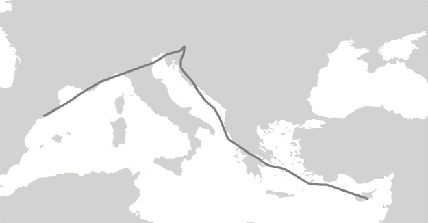
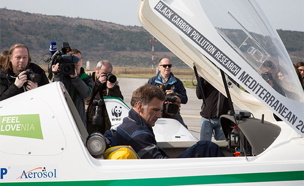
GLWF 2019 - Spain - Cyprus
Flight plan:
Slovenia, Italy, France, Spain, Croatia, Greece, Cyprus
Flight data:
- Date: June 21st 2019 to July 11th 2019
- Distance: 9,500 km / 5,126 nm
- Flights: 15
- Average ground speed: 233 km / h / 126 kts
- Average flight altitude: 1,524 m / 5,000 ft
- Maximum flight altitude: 4,328 m / 14,200 ft
- Average fuel consumption: 16.3 liters / h
- The longest flight: 1,393 km / 752 nm
- Total flight over the ocean: 2,500 km / 1,349 nm
- Fuel Type: Mogas 95, Avgas 100LL
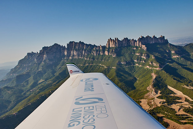
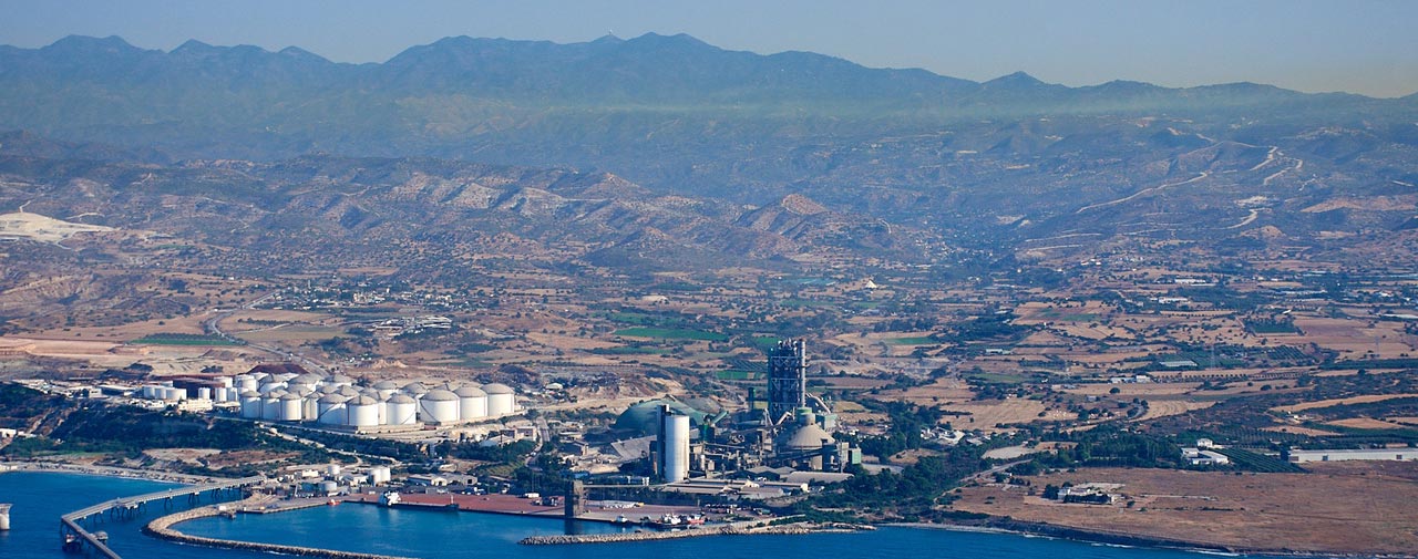
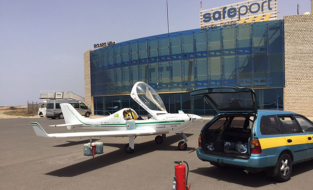
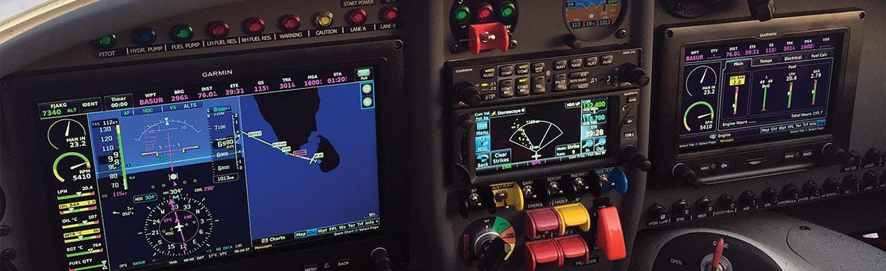
GLWF 2019 spent summer months in Catalonia and Cyprus where partly join DNAAP (Detection of Non-Anthropogenic Air Pollution) campaign co-ordinated by Aerosol d.o.o. which was co-financed by RS and EU. We have been lucky with perfect condition to measure Sahara dust mixed with anthropogenic pollution like black carbon around Barcelona. Non-anthropogenic air pollution is extremely important as it has strong influence to the health of all living beings and speed up climate changes. We flew together with Domen Grauf as flying in complicated controlled airspaces with number of complicated instruments on board is a full time job for two pilots. Dr. Griša Močnik and dr. Luka Drinovec took care for scientific part of the project, designing, maintaining instruments, collecting data and preparing draft reports.
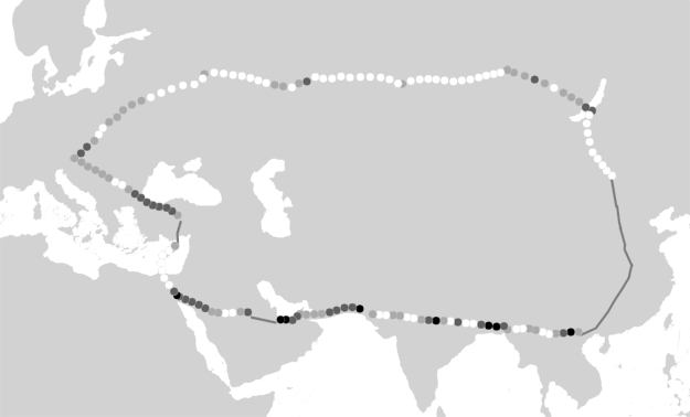
GLWF 2018 - ASIA 2018
Flight plan:
Slovenia, Croatia, Serbia, Bulgaria, Turkey, Cyprus, Egypt, Saudi Arabia United Arab Emirates, Oman, Pakistan, India, Bangladesh, Myanmar, Laos, Vietnam, China, Mongolia, Rusia, Belarus, Poland, Slovakia, Hungary.
Flight data:
- Date: April 9th 2018 to May 10th 2018
- Distance: 22,500 km / 12,141 nm
- Flights: 16
- Average ground speed: 220 km/h / 119 kts
- Average flight altitude: 3,048 m / 10,000 ft
- Maximum flight altitude: 4,602 m / 15,100 ft
- Average fuel consumption: 17 liters / h
- The longest flight: 2,587 km / 1,396 nm
- Total flight over the ocean: 2,100 km / 1,133 nm
- Fuel Type: Mogas 95, Avgas 100LL
During the campaign GLWF 2018 we measured contributions from natural and anthropogenic sources. Desert dust, which is coarser, contributes significantly lower in the atmosphere. We have seen this especially over the Arabian Peninsula. It is noteworthy that also here very close to the ground anthropogenic combustion sources dominate. High in the atmosphere, products from fossil and biomass fuel combustion contribute most to the heating.
Concentrations of absorbing aerosols depend on the activity of the sources, dispersion in the atmosphere and the rate of deposition. Atmospheric mixing is very efficient over deserts and in the tropics due to large differences in temperature at night and during the day. Over Siberia, precipitation efficiently removed aerosols from the atmosphere despite forest fires over which the instrumented plane flew.
The influence of the emissions on the ground can reach high in the atmosphere and different sources influence the climate differently. This depends on the type of generated aerosols. This pollution is dispersed regionally depending on meteorological conditions, which are also responsible for the aerosol removal from the atmosphere. The influence of the sources may be regional, but usually local sources dominate.
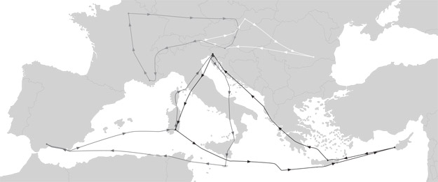
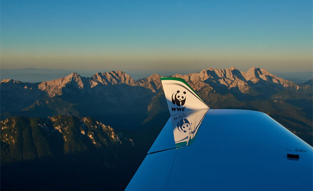
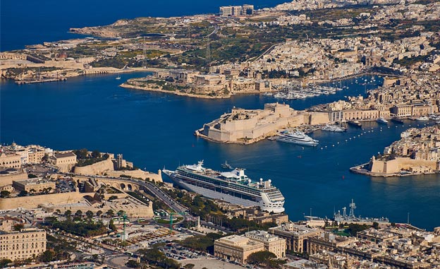
GLWF 2017 - Mediterranean
Flight plan:
Slovenia, Italy, Malta, Tunisia, Algeria, Spain, Libya, Greece, Cyprus, Albania, Serbia, Croatia, France, Slovakia, Austria, Czech Republic, Germany, Hungary, Romania
Flight data:
- Date: March 24th, 2017 – July 7th 2017
- Distance: 18 000 km
- Flights: 15
- Flight hours: 80
- Average ground speed: 121 kts
- Average flight altitude: 8 500 ft
- Maximum flight altitude: 14 000 ft
- True airspeed TAS: 132 kts
- Average fuel consumption: 16.5 l/h
- Best economy: 12 l/h
- Minimum fuel consumption at 14 000 ft: 12 l/h
- The longest flight: 2300 km
- Total flight over the ocean: 5 700 km
- Fuel type: Mogas 95, AVGAS 100LL
We have collected data on carbon black across the Mediterranean, from Cyprus to southern Spain, and we have observed the spreading of desert dust in the north all the way to Paris. Preliminary checks of the collected data have showed that not only does the Saharan dust spread along the Mediterranean and reach the Alps, but in right weather conditions it also reaches northern Europe, settles on snow and ice in the Alps and it increases airborne particle concentration.
Interestingly, the data show that the Saharan dust is mixed with black carbon. It must be investigated, how this affects climate and where the sources of air pollution with black carbon are. The answer to this question can be found through a detailed analysis and the combination of air and ground measurements that can differentiate between the Saharan dust and the small aerosols of black carbon, and that can determine their properties. Alongside air measurements, these measurements were performed in Cyprus in collaboration with the local scientists.

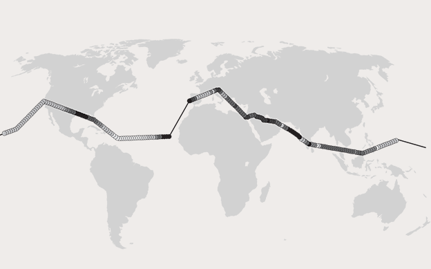
GLWF 2016 - World Flight
Flight plan
Italy, France, Spain, Morocco, Western Sahara, Mauritania, Cape Verde, Martinique, Virgin Islands, Puerto Rico, Turks and Caicos, Bahamas, Florida, Louisiana, Texas, New Mexico, Arizona, Nevada, California, Hawaii, Marshall
Islands, Micronesia, Guam, Philippines, Borneo, Malaysia, Thailand, Sri Lanka, India, Oman, United Arab Emirates,
Qatar, Bahrain, Saudi Arabia, Egypt, Greece, Albania, Montenegro, Croatia.
Flight data
- Date: January 8th 2012 to April 19th 2012 - 61 flying days
- Distance: 91003 km / 49 138 nm
- Flights: 60
- Flight hours: 369
- Average ground speed: 247 km / h / 133 kts
- Average flight altitude: 10,000 ft
- Maximum flight altitude: 8,965 m / 29,413 ft
- True airspeed TAS: 140-145 kts
- Average fuel consumption: 18.1 liters / h
- Best economy at 10,000 ft, TAS 133 kts: 16.7 liters / h
- Minimum fuel consumption at 4000 m: 16.5 l / h
- The longest flight: 3,593 km / 1,940 nm
- Total flight over the ocean: 33,100 km / 17,873 nm
- Fuel Type: Mogas 91, 93, 95 octane, AVGAS 100 LL AVGAS 100-130
We encountered new areas with extremely high black carbon concentrations above parts of the developed world, such as the Gulf of Mexico coast. Measured concentrations indicate that the pollution above this area is most probably caused by oil extraction and refining. Industrial emissions and air pollution from this source were successfully reduced in Europe, and this is one of the greater achievements in decreasing environmental pollution. Therefore, we tend to forget that industry can be an important source of pollution in the developed world.
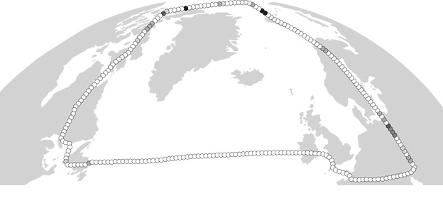
GLWF 2013 - North Pole
Flight plan:
Austria, Czech Republic, Germany, Sweden, Norway, Canada, Ireland, England, France, Italy
Flight data:
- Date: April 22nd 2013 to May 26th 2013 - 11 flying days
- Distance: 17,050 km / 9,206 nm
- Flights: 11
- Flight hours: 61
- Average ground speed: 278 km / h / 150 kts
- Average flight altitude: 10,000 ft
- True airspeed TAS: 130-145 kts
- Average fuel consumption: 17 liters / h
- Best economy at 10,000 ft, TAS 133 kts: 16.7 liters / h
- Minimum fuel consumption at 4000 m: 16.5 l / h
- The longest flight: 3,189 km / 1,722 nm
- Total flight over the ocean: 6,500 km / 3,510 nm
- Fuel Type: Mogas 91, 93, 95 octane, AVGAS 100 LL
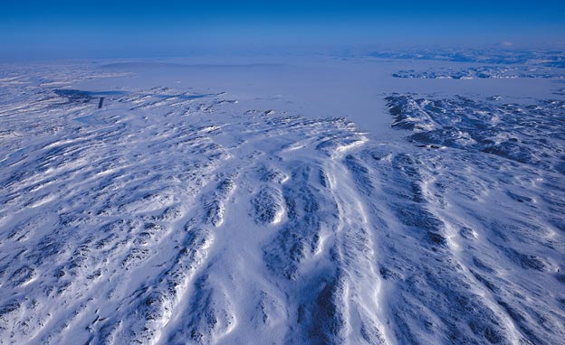
Black carbon concentrations above the Arctic were very low as we anticipated, since the areas are far from all sources of pollution. We nevertheless identified a well-defined area of pollution during the flight to the North Pole. The concentrations increased up to the values expected on the ground in cities. The calculated back-trajectories show the source of this black carbon are industrial activities around Norilsk, and oil extraction and refining. Oil extraction is accompanied by flaring, and this is the largest source of black carbon pollution above the Arctic.
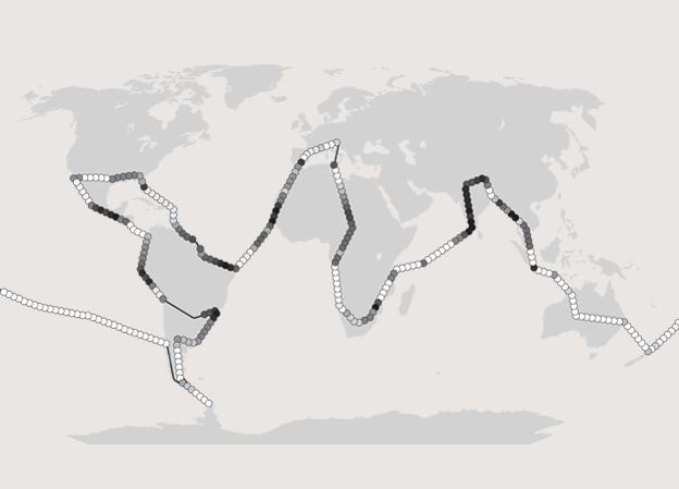
GLWF 2012 - World Flight
Flight plan:
Italy, France, Spain, Morocco, Western Sahara, Mauritania, Senegal, Brazil, French Guiana, Suriname, Puerto Rico, the Caribbean, Florida, Alabama, Mississippi, Louisiana, Texas, California, Mexico, Guatemala, El Salvador, Nicaragua, Costa Rica, Panama , Ecuador, Peru, Argentina, Chile, Antarctica, French Polynesia, New Zealand, Australia, Indonesia, Malaysia, Thailand, Myanmar, Bangladesh, Nepal, India, Seychelles, Tanzania, Mozambique, South Africa, Namibia, Angola, Congo, Central African Republic , Chad, Niger, Libya, Tunisia.
Flight data:
- Date: January 8th 2012 to April 19th 2012 - 61 flying days
- Distance: 91003 km / 49 138 nm
- Flights: 60
- Flight hours: 369
- Average ground speed: 247 km / h / 133 kts
- Average flight altitude: 10,000 ft
- Maximum flight altitude: 8,965 m / 29,413 ft
- True airspeed TAS: 140-145 kts
- Average fuel consumption: 18.1 liters / h
- Best economy at 10,000 ft, TAS 133 kts: 16.7 liters / h
- Minimum fuel consumption at 4000 m: 16.5 l / h
- The longest flight: 3,593 km / 1,940 nm
- Total flight over the ocean: 33,100 km / 17,873 nm
- Fuel Type: Mogas 91, 93, 95 octane, AVGAS 100 LL AVGAS 100-130
The GLWF 2012 flight concluded very successfully, as we gathered a vast amount of data. We pushed our instruments to their limits – we were measuring concentrations from a few ng/m. (ng/m. is nanogram per cubic meter, a billionth of a gram of black carbon in one cubic meter of air) above oceans to several thousand ng/m. above inhabited areas. Some high concentrations of black carbon were in certain cases probably a consequence of slash-and-burn agricultural techniques, for example above Malaysia and the Congo River. We measured increased black carbon concentrations above South-East Asia, with an extremely interesting event above the Thailand-Myanmar border where we measured a big increase in concentrations.
- General Eco partner

- Green partner

- Scientific partners


- Technical partner
